Ottoman Heritage in Greece: Map and Bibliography is an openly accessible web-based mapping application that connects the bibliography of Ottoman sites and monuments to an interactive map. The map was developed using the open-source location intelligence and web mapping platform Carto that supports web-based rendering, geospatial analysis and visualization of different types of datasets. On the “Ottoman Heritage in Greece” applications, users can dynamically visualise about 600 monuments and 1.600 bibliographical entries on a map based on their type. Each georeferenced site is linked to related bibliographic entries.
Ottoman Heritage in Greece: Map and Bibliography can be accessed by clicking on the map below:
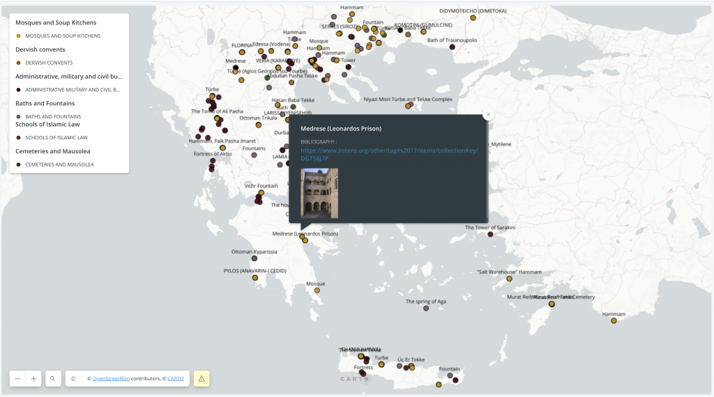
The application’s content comprises official monuments (protected under the Archaeological Law 3028/2002), ruins within cultural landscapes, buildings that changed use during the transition from the Ottoman Empire to the Greek State (from mosques to churches, etc.), as well as important extinct monuments for which there is information available.
Data collection was supported by the Researchers’ Network of Otheritages which consists of academics, members of staff of the relevant Ephorates of Antiquities, as well as archaeology aficionados. Constant update of content secures the sustainability of the application. Thus, Ottoman Heritage in Greece: Map and Bibliography is a useful public humanities tool that brings digital technology into the critical study of material culture of the Ottoman past.
Credits
General curatorship and academic supervision
Elias Kolovos and Panagiotis C. Poulos
Planning and implementation of the mapping application
Samia Samara
Data entry coordinator
Samia Samara and Faidon Moudopoulos-Athanasiou.
Data entry: Samia Samara (EFA 2017-2018), Sophia Maraveli (NKUA Intern, 06/2018-10/2018), Orestis Ferekides (NKUA Intern, 06/2018-10/2018), Faidon Moudopoulos-Athanasiou. (EFA, 2020-2021).